CAPE CHARLES, Va. — The National Oceanic and Atmospheric Administration’s Office for Coastal Management has released a new interactive tool designed to help communities, planners and residents prepare for sea level rise and flooding risks along the nation’s coasts.
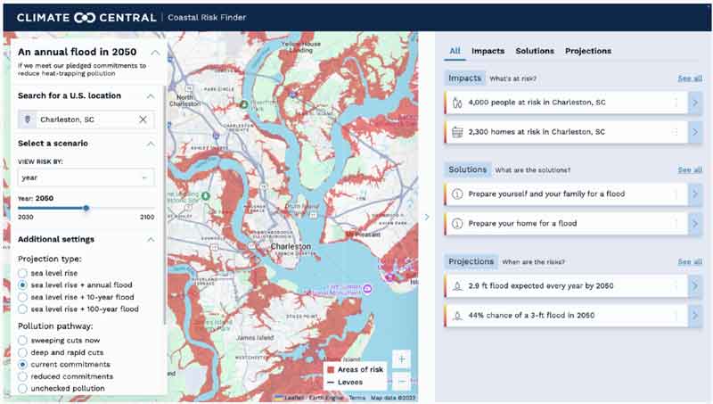
The Coastal Risk Finder allows users to customize scenarios for sea level rise and coastal flooding, offering projections for specific years, flood levels and pollution scenarios. The tool highlights the potential impact on people, land and homes, while also providing localized maps, statistics and graphics that can be shared with the public.
In addition to data, the site connects users with adaptation resources, including state-by-state coastal resilience efforts, organizations and policies. It also offers information on how individuals and communities can prepare for the increasing risks associated with climate change.
NOAA officials said the tool is designed to be accessible to a wide range of users, from local governments and emergency planners to homeowners and business owners in coastal regions.
The Coastal Risk Finder can be accessed at: https://coast.noaa.gov/digitalcoast/tools/coastal-risk-finder.html


Was 'crush and run' not good enough?
Ok Cathy Parks. You do realize that the internet you use is powered by AI don't you? Are you calling…
Anyone skeptical or resisting Artificial Intelligence and especially those who think this compares to real vanilla versus fake vanilla, my…
Awe did I upset you too Cathy? Booohoooo lol
No. I am one of your neighbors. I don't need to go on the internet when I see you on…