
A harmful algal bloom is spreading through the lower Chesapeake Bay, prompting federal and state scientists to track its movement using satellite imagery and water sampling.
The National Centers for Coastal Ocean Science (NCCOS) reports that fluorescence data show blooms affecting the lower Bay and all major tributaries along Virginia’s western shore. Partners at Old Dominion University (ODU), the Virginia Institute of Marine Science (VIMS), and the Maryland Department of Natural Resources have confirmed high concentrations of Margalefidinium polykrikoides, an algae species known for producing large, harmful blooms.
Tracking the Bloom
The outbreak was first detected in July in the Lafayette River near the Norfolk Yacht & Country Club. ODU researchers, who sample bay waters several times a week during peak bloom season, confirmed the species on July 22, according to Margie Mulholland, a professor of ocean and earth sciences at ODU. Scientists have since nicknamed the bloom “Marge.”
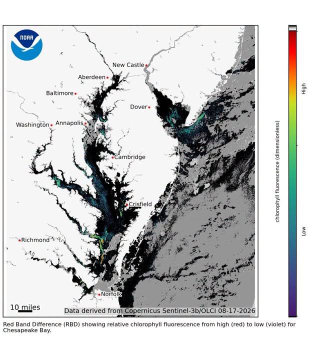
NOAA scientists picked up the bloom’s movement through satellite imagery as shifting currents carried it through the region. It has since spread into parts of the James and York Rivers and reached the Oceanfront. While the bloom appears to be dissipating, a separate patch spotted near Tangier Island may be connected to it, Mulholland said.
NCCOS uses satellite monitoring tools developed with NOAA’s Satellite and Information Service CoastWatch program to help resource managers in Virginia and Maryland respond to bloom conditions in real time.
Why It Matters
Algae form the base of the bay’s food web, but blooms turn harmful when algae overgrow. Some produce toxins dangerous to people and marine life. Others aren’t toxic themselves but consume oxygen as they decay, creating low-oxygen “dead zones,” and can block sunlight from reaching underwater grasses.
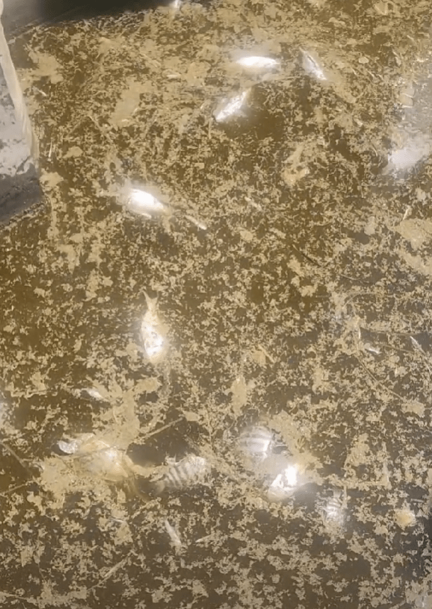
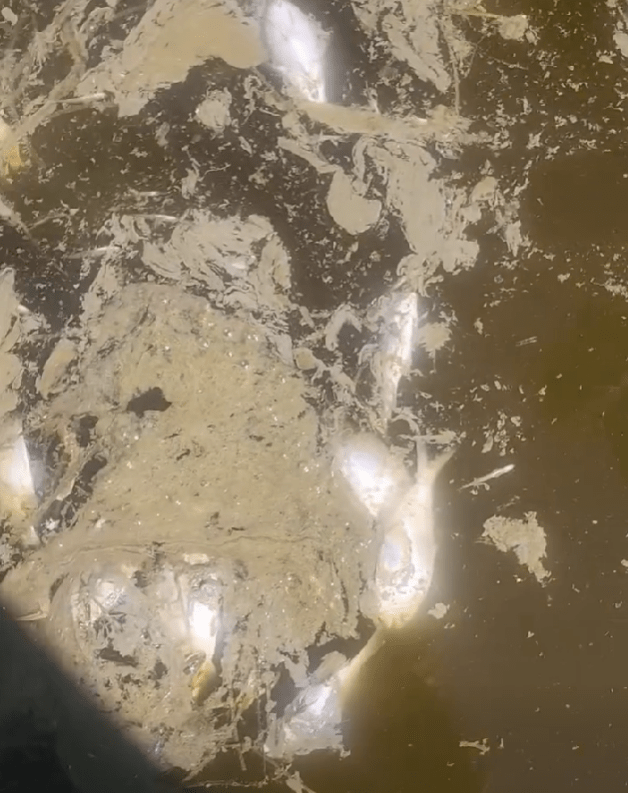
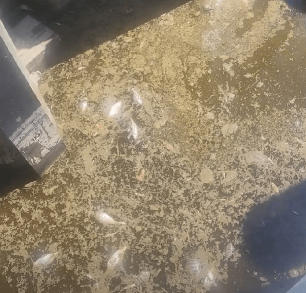
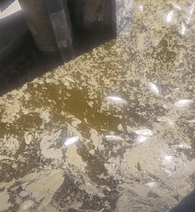
Images: Cape Charles Harbor (Photos courtesy of Scott Wivell).
Blooms are typically fueled by nutrient pollution, such as fertilizer runoff, and tend to multiply faster in warmer water. Still, Mulholland noted that scientists don’t fully understand what triggers individual bloom events.
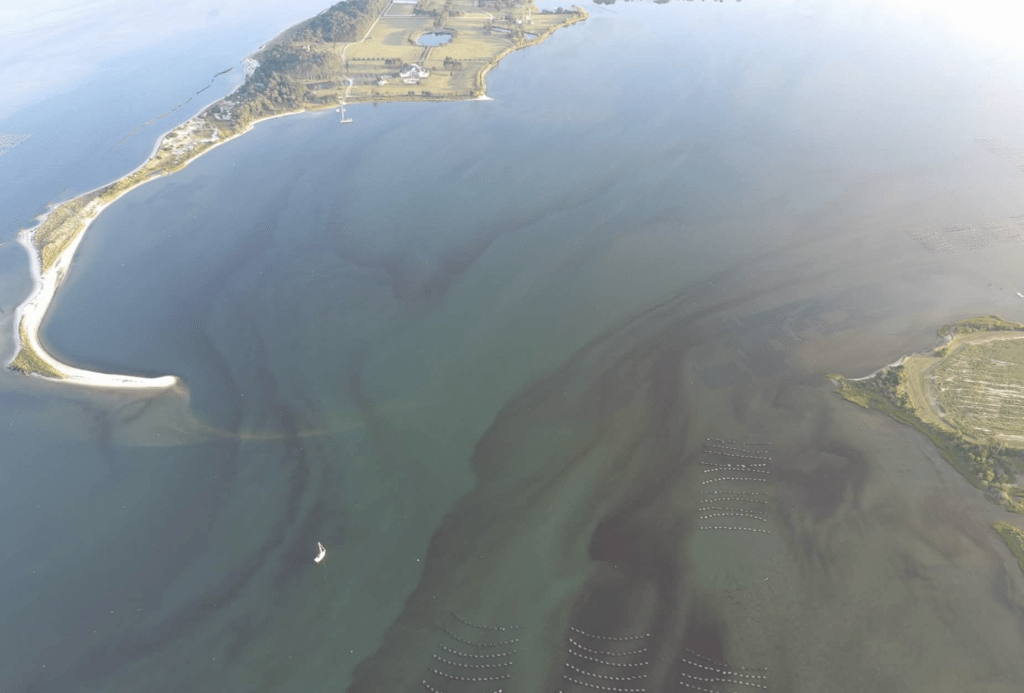
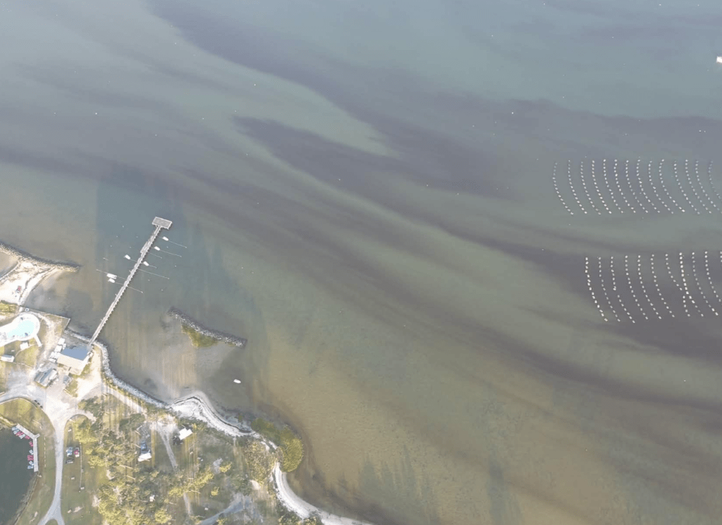
Margalefidinium polykrikoides has bloomed nearly every year in the lower bay since it first appeared in the early 1990s, though it was notably absent the past several summers. Because these blooms create muddy red streaks in the water, they’re often called “red or mahogany tides.”
Ongoing Monitoring
ODU is part of a broader coalition studying algal blooms in the bay, alongside the state, NOAA, VIMS, and the Mid-Atlantic Regional Association Coastal Ocean Observing System. The group is working to develop a real-time alert system to warn the public when harmful algae levels rise.
About the Author



A southern democrat.
Hey "Bob" I take your comment as if this was coming from an idiot. How about using your real name…
A free ride to a polling place to act like an American. Of course someone has an issue with it.
They are simply Road Pirates, nothing more, nothing less.
Unwanted gentrification without proper assimilation.